There was an article in the Guardian some years back that described Bicester as ‘a humdrum town on the less-lovely side of Oxfordshire‘. In some ways I think this is unfair…. but it’s also not exactly incorrect. I’ve always described Bicester as a nice enough place to live and well-linked transport-wise to almost everywhere else I’d want to go. I’m not sure that Bicester Tourist Board (if it exists) would use my endorsement of ‘you can get to anywhere from Bicester’ as an advertising slogan though.
It turns out that the Bicester of today is shaped by location (in the less-lovely side of Oxfordshire – by which is meant, I think, the ‘flat part’) and transport links in, out and through. And because I like understanding how landscape shapes how urban societies grow, and how human communities in turn shape and influence the natural environment, I have begun to find Bicester a lot more interesting than it initially appears. This relationship between how we live and the underlying geography is what I am choosing to define as ‘psychogeography’ (hence the title of this blog) although scholars of the term may disagree.
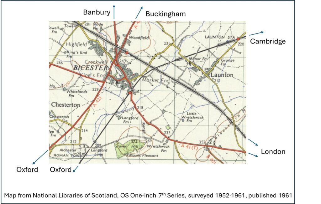
Transport in and out of Bicester is best understood from a map. Although Bicester has grown a lot since, I’m using the 1961 OS Map to illustrate this, as it shows the features well.

A Roman road bisects Bicester and forms the modern day Buckingham Road (labelled Roman Way on older maps) and Oxford Road. In the bottom left of the map you can see the site of the old Roman town of Alchester. Apparently there are significant remains, although when I walked out there it just looked like a field. The other major roads eventually go to London (via Aylesbury) and Banbury but pre-motor vehicle they may have predominantly been routes to neighbouring villages.
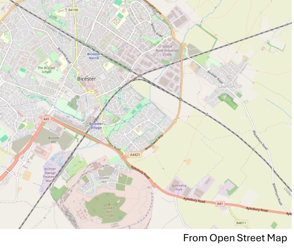
The town is further segmented by two railway lines; the older Varsity Line and the new kid on the block (c. 1910) London to Birmingham line. The former Oxford to Cambridge line now goes no further east than Bicester, before diverting up the Bicester chord to join the Chiltern Mainline to London Marylebone. However, work is well-advanced to lay track and re-open the full route from Oxford to Bletchley (initially) within the next few years, as part of the East West Rail project. The present day Open Street Map showing the same area as the 1961 map above illustrates how the underlying plan of the major roads and railways is unchanged, although Bicester has now gained a ring-road.

Bicester has clearly grown enormously over the last 60 years and it is especially interesting to see its expansion compared to the neighbouring village of Launton. It looks like someone drew a circle around Bicester in 1961 and proceeded to fill in the gaps, like a paint by numbers. If you look closely though, there are gaps still unfilled. These are largely around rivers, streams and brooks, as the flat-lands of Bicester are prone to flood, so its best to leave them some space. Railway and MOD land provide some green corridors and wild spaces. For centuries, the land upon which Bicester is built was farm land. The modern street-plan of Bicester is hence superimposed on an older shadow-plan of field boundaries, public footpaths and rights of way. You can walk through and out of Bicester following the footsteps of former residents from hundreds of years ago.

One response to “Is Bicester boring?”
Interesting. I don’t think Bicester is boring. It looks very complex to me!